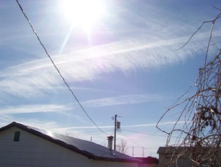
Looking south, about noon. This photo shows different stages of contrail "flare" based on how
long they've been hanging in the sky. Three east-west contrails are still defined, while at least
three others can be made out that cross those at different angles. Toward the southern horizon can
be seen the thin but almost complete contrail cover that is so often spread over that part of the
sky.
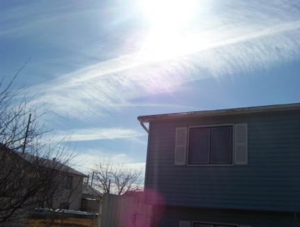
The same contrails as in the preceding photo, a bit later and looking a bit more southeast. The big
contrail across the center is being spread by a north breeze, but is not dissipating. All the
contrails in this photo seem to be increasing in thickness and density, a fairly common
phenomenon in which these types of contrails will sometimes join together in a surprisingly thick
covering that becomes difficult to tell from natural clouds. The discerning observer, on such
days, must keep reminding himself that the clouds in view actually had their source in contrails.
Such clouds are not natural; they are man made. What is in this exhaust that makes it behave like
this?
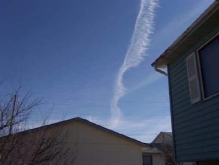
Looking east, later in the day. The most recent contrail is being affected by a north breeze which
is spreading it, but not causing it to dissipate. Above it are the remains of earlier contrails that
have spread into a thin cloud cover during the hours they have hung in the sky. Toward the
horizon appears a thicker cover of lasting contrails. Not a natural cloud can be seen in the
sky.
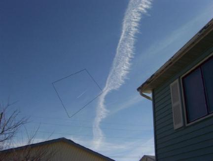
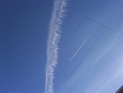
Take a close look inside the polygon where a plane is making a contrail that is disappearing like
contrails always used to do, and unlike the other contrails made before it that same day that
continue to hang in the sky and create that by-now-well-familiar unnatural cloud cover. While
it's hard to judge the altitude of this plane relative to the contrail clouds, it seems certain that the
altitude is at least as high, and likely even higher, than the broad, flaring contrail touched by the
right-most corner of the polygon, and is probably close to the same altitude as the thinner
contrails that have spread across the sky. Why is the new contrail disappearing while the others
persist? Who can answer that question? If anyone can send me a letter or an
email answering this, I'll post it right here
under this picture.
Inside the polygon is another plane making another disappearing contrail, unlike the others that
have lasted an extended period of time and are creating a partial cloud cover. Again, it's difficult
to judge the altitude of this plane, but it seems to possibly be between the flaring contrail and the
higher ones that have persisted long enough to create that much-too-familiar southwestern
Montana cloud cover. As above, if anyone can explain this in a letter or
email, I'll print it right here under this
picture.